Designing a Community Mapping Platform: Geospatial Data, Field Usability, and Offline-First Design

A community mapping platform is a system that lets a distributed group of people record, share, and find geographic information in one place, combining a spatial database, a map interface, and a field-friendly capture tool. Building one is a specific engineering discipline because it has to satisfy four concerns at once: rigorous geospatial data, usability for non-specialists working in the field, reliable operation when the network is weak or absent, and trustworthy data from many contributors.
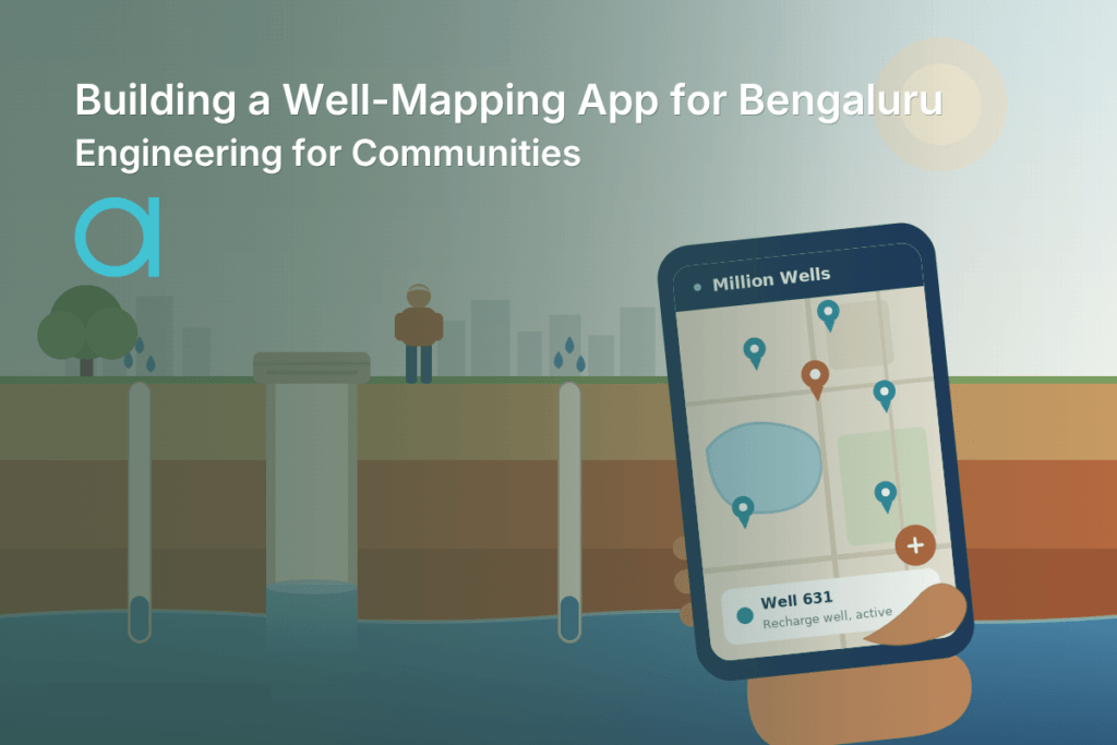
This guide walks through the architecture of a community mapping platform, using the Million Wells App as the running example: a community map of Bengaluru’s wells for Biome Environmental Trust’s Million Wells Campaign, used by Biome staff, residents, and the Mannu Vaddars, the city’s traditional well diggers. The credit is shared. Design for Good’s team, Adira Andlay, Rocio Calderon Castro, and Xin Wen, led the service and UI/UX design and the field research; Atta Systems, as the pro bono development partner, developed, troubleshot, and tested the app. It went live in August 2025 and had mapped 630 wells as of the Design for Good 2026 Impact Report (August 2026).
The patterns below describe what this class of platform requires. The Million Wells App shows the problem each one solves; this guide does not document the app’s internal stack.
The four concerns that shape the architecture
A community mapping platform must satisfy four concerns at once, and its architecture is the set of decisions that resolves the tension among them.
- Geospatial rigor. The data is spatial, so it needs a real spatial data model, consistent coordinate handling, and formats other systems can read. Latitude and longitude stored as two plain numbers in a generic database fall short of that.
- Field usability. The primary users are often non-specialists working outdoors on their own phones, so capture and lookup have to be fast, forgiving, and easy to use on a small screen.
- Offline-first operation. Fieldwork happens in areas with intermittent connectivity, so every core task must work without a connection.
- Trustworthy community data. Many contributors with different expertise and equipment add records, so the platform needs validation that keeps the map accurate while keeping contribution easy.
A generalist team tends to solve one of these and bolt the others on, which is why many mapping projects work in a demo and fail in the field. Each concern gets a section below.
Geospatial data: modeling place properly
In a community mapping platform, geospatial rigor starts with treating location as first-class data: a spatial data model, a consistent coordinate reference system, and interchange formats built for geographic information. The core record is a point with a small set of attributes and a location accurate enough to be found again. Getting that right takes more than storing two numbers.
The data layer has four building blocks:
- A spatial database on the server. PostGIS, the spatial extension to PostgreSQL, stores features as geometries, enabling spatial queries such as finding all records within a radius or detecting duplicates by proximity. This is the authoritative record.
- A consistent coordinate reference system. Locations are stored in one defined reference system, in practice WGS84 (EPSG:4326), the latitude-longitude system GPS uses, so every contributor’s point lands where it should.
- Open interchange formats. GeoJSON is the standard format for moving features between systems. GeoPackage (GPKG), a single SQLite file that holds vector features, raster tiles, and their coordinate metadata, is the common container for taking data offline. Open formats keep the data portable across applications.
- Positioning that records its accuracy. Phone GNSS (Global Navigation Satellite System, which includes GPS) is sufficient for most community mapping, but consumer positioning can be off by several meters, so the platform should store the reported accuracy for each point. Where precision matters, external receivers using RTK (real-time kinematic) correction achieve centimeter-level accuracy.
With a proper data layer, the map becomes a queryable spatial dataset. That is what lets the platform find, deduplicate, and export records, and what lets other users, such as a city’s water planners or a research team, work with the data without a bespoke integration.
Field usability: designing for the phone in someone’s hand
Field usability in a community mapping platform means the interface is built for a non-specialist working outdoors on the device they already own. For the Million Wells App, Design for Good’s team worked directly with the well diggers, using questionnaires and field research to understand their day-to-day practices and smartphone use. Their research found that any digital tool in this context needs simplicity and clarity above all else, because users have varying levels of familiarity with smartphones. Atta Systems then developed the app and user-tested it with the well diggers. That finding applies to the client layer of any comparable platform.
Designing the capture flow
Recording a feature at the point of work is the most important interaction, and it should take a few taps: drop a pin at the current location, fill in a short structured form that prevents errors through predefined choices, and save, with or without a connection. The standardized form is also the first line of data quality, because it constrains input to valid values before anything reaches the database.
Rendering the map on mid-range phones
A community map can hold thousands of features and still has to pan and zoom smoothly on a mid-range phone. Vector tiles, compact, styleable map data encoded as Protocol Buffers, render large datasets far more efficiently than shipping raw features, and pre-generated basemap tiles keep the map responsive. Performance should be tested on the oldest devices the users carry, since that is where it fails first.
Designing for varying smartphone familiarity
For a community tool, accessibility sets the threshold for adoption. If a contributor cannot record an entry on their own phone without training, the platform goes unused, and the map goes stale. Designing for a wide range of users, languages, literacy levels, and devices is central to the work. Device range is also where these projects stay hardest: on the Million Wells App, users with older phones cannot yet access all features, and that remains an open challenge.
The same discipline applies to Species+, the app Atta Systems built for the UN Environment Programme World Conservation Monitoring Centre, which works offline and is designed for officers with varying levels of technical expertise.
Offline-first: designing for intermittent connectivity
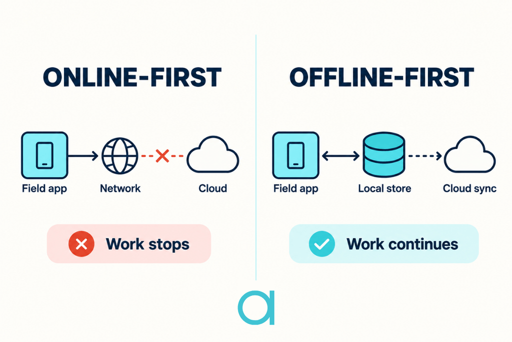
Offline-first design means a community mapping app reads from and writes to a local store first, then synchronizes with the server in a separate process, so the user can work whether or not they are connected. Caching the last server response is a weaker pattern, because it only helps until the user tries to change something. In an offline-first app, capturing a record, browsing the map, and editing an attribute all work without a signal, and the data is reconciled with the server later.
Offline-first requires four things:
- A local store as the primary source. The app reads from and writes to an on-device database, such as SQLite, that stores the current state, including pending changes, so the interface never waits on the network. Offline map tiles in an MBTiles or GeoPackage container travel with the app, so the map works without a connection too.
- An outbox for offline writes. Changes made offline are queued locally, marked pending, and sent when a connection returns, with retry and backoff so a flaky signal does not lose data. The user sees the change immediately as an optimistic update.
- Delta sync. When connectivity returns, the app exchanges only what has changed since the last sync, keeping synchronization fast and cheap on slow or metered field connections.
- A conflict-resolution strategy chosen deliberately. When two people edit the same record offline, the system needs a defined rule. The three main options are compared below.
| Strategy | How it works | Trade-off | Best fit |
|---|---|---|---|
| Last-write-wins | The most recent edit replaces earlier ones | Simple to build; can silently discard an edit | Records rarely edited by more than one person |
| Field-level merge | Changes to different fields are combined; true clashes go to a rule or a reviewer | More logic to build; far fewer lost edits | Shared records where different people update different attributes |
| CRDTs (conflict-free replicated data types) | Data structures designed so concurrent edits merge automatically and consistently | Highest engineering cost; suits specific data shapes | Collaborative editing at scale |
For a well database, the practical result is that a well digger records a well at a site with no signal, sees it on their own map immediately, and finds it merged into the shared database once back in coverage, with no duplicate and no lost edit. That behavior comes entirely from offline-first design.
Trustworthy community data: validating crowdsourced records
Data quality is a concern unique to a community mapping platform: when many contributors with varying expertise and equipment add records, the platform must keep the map trustworthy without discouraging contributions. Researchers study this under participatory GIS (geographic information systems) and volunteered geographic information (VGI), and the established answer is a validation pipeline that checks records as they arrive.
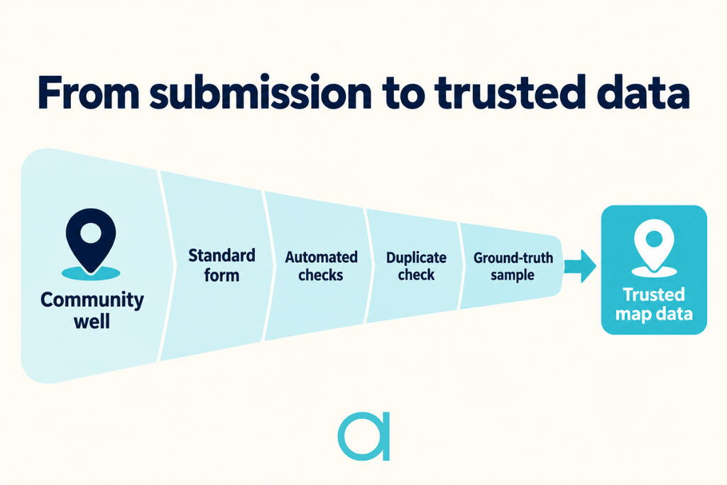
A community map stays trustworthy through four steps:
- Constrain input at capture. Standardized forms with predefined values and required fields prevent many errors from entering the database, which is cheaper than fixing them later.
- Validate automatically. Rules flag entries with out-of-range values, coordinates outside the mapped area, or impossible attribute combinations, and detect likely duplicates by proximity before a record is trusted.
- Cross-reference and ground-truth. Community data is checked against authoritative datasets where they exist, and a sample is verified in the field, the established way to keep a crowdsourced map accurate without reviewing every point.
- Keep contribution easy. The value of a community platform is that local knowledge, such as the well diggers’ understanding of the shallow aquifer, becomes shared data. Validation should protect the map’s integrity while keeping the barrier to contribution low.
Atta Systems builds platforms like the Million Wells App with all four concerns designed together, because a platform that handles only one of them tends to fail in the field.
FAQ about community mapping
Community mapping is the practice of people documenting the places, resources, and features of their own area so that local knowledge becomes shared information. It ranges from paper maps drawn in workshops to digital platforms where contributors add records from their phones. A community mapping platform is the software form of the practice: the users are the data source, often working in the field.
Start by defining what a record is and the few attributes that matter, then choose a capture method contributors can use on their own phones, a spatial store for the data, and a rule for validating submissions. Pilot the capture flow with real contributors in the field before scaling, since usability problems surface there first. For larger or long-running projects, plan offline operation and sync from the start, because they are expensive to add later.
Off-the-shelf field data collection tools such as ArcGIS Field Maps, KoboToolbox, or ODK (Open Data Kit) are well-suited for standard surveys conducted by trained staff. A custom platform makes sense when the contributors are the public or a specific community, when the capture flow must fit their skills and language, or when the data must feed a campaign or public system that those tools do not integrate with. The Million Wells App is an example of the second case: its design was built around how the well diggers use their phones.
Atta Systems builds government and public-sector software, including platforms like the Million Wells App.
Its work covers public bodies, international organizations, and community initiatives that need custom software for people working in the field.

Related Articles